

Car navigation systems have transformed the way people travel. Instead of relying on printed maps or roadside directions, drivers now receive precise turn-by-turn guidance in real time. These systems combine satellite communication, digital mapping, sensors, and intelligent routing algorithms to help drivers reach their destinations efficiently and safely.
Understanding how these systems operate reveals the sophisticated technology working quietly behind every guided journey.
What Is a Car Navigation System
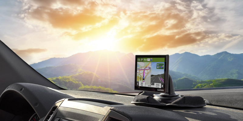
A car navigation system is an integrated electronic tool that determines a vehicle’s location and guides drivers along the best route to a selected destination. It typically includes a display screen, GPS receiver, onboard software, and digital map database.
Modern navigation systems can:
- Detect your exact location
- Suggest the fastest or shortest route
- Provide voice-guided directions
- Display traffic conditions
- Suggest alternate routes when delays occur
These features work together to reduce travel uncertainty and improve driving efficiency.
The Role of GPS in Navigation Systems
The backbone of any car navigation system is the Global Positioning System, commonly known as GPS. It relies on a network of satellites orbiting Earth that constantly transmit signals to receivers on the ground.
Your vehicle’s navigation unit receives signals from multiple satellites simultaneously. By calculating how long each signal takes to arrive, the system determines your precise location on the planet.
GPS enables navigation systems to:
- Identify latitude and longitude coordinates
- Track vehicle movement continuously
- Update routes instantly during travel
- Maintain location accuracy even over long distances
Without GPS, modern vehicle navigation would not be possible.
How Location Tracking Actually Work
Car navigation systems use a method called trilateration to determine vehicle position.
Here is how it works step by step:
- The GPS receiver connects with signals from at least three satellites.
- Each satellite provides distance data between itself and the vehicle.
- The navigation unit calculates where those distances intersect.
- A fourth satellite improves accuracy by correcting timing errors.
This process happens continuously while driving, allowing the system to update your position every second.
Digital Maps and Route Calculation
Once the vehicle’s position is known, the navigation system consults its digital map database. These maps contain detailed information about:
- Roads and highways
- Speed limits
- Traffic directions
- Intersections
- Landmarks and addresses
The system’s software then calculates the best route using algorithms that consider distance, travel time, and road conditions.
Some advanced systems also factor in:
- Real-time traffic congestion
- Construction zones
- Road closures
- Weather-related delays
This ensures the driver receives the most efficient path available.
Sensors That Improve Navigation Accuracy
Car navigation systems do not rely only on satellites. They also use onboard vehicle sensors to maintain accuracy when GPS signals weaken.
Common supporting sensors include:
- Wheel speed sensors
- Gyroscopes
- Accelerometers
These components help track motion when driving through tunnels, underground parking areas, or dense urban environments where satellite signals may temporarily drop.
This process is called dead reckoning and allows navigation guidance to continue smoothly.
Voice Guidance and User Interface Technology
Voice guidance is one of the most practical features of navigation systems. Instead of constantly looking at the screen, drivers receive spoken instructions such as when to turn or exit a highway.
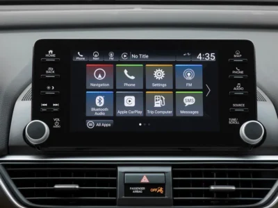
The user interface also plays an important role. Modern systems offer:
- Touchscreen controls
- 3D map visualization
- Lane assistance displays
- Speed limit alerts
- Destination suggestions
These features improve both usability and safety during driving.
Real-Time Traffic Updates and Connectivity
Modern navigation systems are increasingly connected to the internet through mobile networks or smartphone integration.
This connectivity allows systems to:
- Monitor live traffic flow
- Suggest alternate routes instantly
- Estimate accurate arrival times
- Identify accidents or congestion ahead
As a result, drivers can avoid unnecessary delays and reach destinations faster.
Integration With Smartphones and Smart Vehicles
Today’s navigation systems often work alongside smartphone apps and connected vehicle platforms.
Common integrations include:
- Apple CarPlay compatibility
- Android Auto support
- Voice assistant interaction
- Cloud-based map updates
These features ensure navigation data remains current and personalized for each user.
Advantages of Using Car Navigation Systems
Navigation systems provide several benefits that improve both convenience and safety.
Key advantages include:
- Reduced travel stress
- Accurate destination guidance
- Fuel-efficient route planning
- Better time management
- Improved driving confidence in unfamiliar areas
They are especially useful during long-distance travel or when exploring new cities.
Limitations of Car Navigation Systems
Despite their usefulness, navigation systems are not perfect.
Some common limitations include:
- Occasional GPS signal loss
- Outdated map data in offline systems
- Incorrect route suggestions in rare cases
- Dependence on connectivity for live traffic updates
However, continuous software improvements are reducing these challenges over time.
The Future of Car Navigation Technology
Navigation systems are evolving rapidly with advances in artificial intelligence and connected vehicle technology.
Future improvements may include:
- Predictive route suggestions based on habits
- Augmented reality navigation displays
- Fully integrated autonomous driving guidance
- Vehicle-to-vehicle communication support
These developments will make navigation systems even smarter and more responsive.
Frequently Asked Questions
1. Do car navigation systems work without internet access
Yes. Built-in navigation systems can function offline using stored maps, although live traffic updates require internet connectivity.
2. How accurate are modern car navigation systems
Most modern systems are accurate within a few meters under normal conditions, especially when multiple satellites are connected.
3. Can navigation systems work inside tunnels
They continue functioning using vehicle sensors and motion tracking until GPS signals become available again.
4. Are built-in navigation systems better than smartphone apps
Built-in systems often integrate better with vehicle sensors, while smartphone apps usually provide more frequent map updates and live traffic data.
5. How often should navigation maps be updated
Ideally, map databases should be updated at least once or twice per year to maintain accuracy.
6. Do navigation systems consume a lot of vehicle battery power
Factory-installed systems are designed to operate efficiently and have minimal impact on the vehicle’s electrical system.
7. Can navigation systems help improve fuel efficiency
Yes. By suggesting shorter and less congested routes, they can reduce unnecessary driving time and fuel consumption.


Comments